The first record of Sturton as a defined settlement appears in the Domesday Book as “Estretone” Over the centuries the name of this village has changed many times, however these changes merely reflected the language of the time, the name “Sturton” means “The Homestead on the Street” The Homestead in question was almost certainly a major Roman settlement with direct links to Segelocum, the “Street” can only be the Roman Street on which it is built.
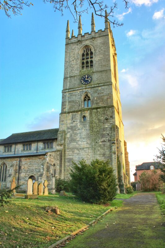
The addition of “le-steeple” in 1823 probably refers to the twelve pinnacles on the Church tower that can be seen for miles around and probably done to differentiate it from Sturton-by-Stow that is on the same road over the river Lincolnshire. The name of Clay, refers to the North Clay Wappentake of the Bassetlaw District in which the village resides. In essence the name of the village has not changed since the Roman occupation, minor changes in spelling merely reflect how language develops through time.
Sturton Le Steeple earliest occupation predates the Roman era who was followed by Saxons and Danes. The Domesday Book records that it was farmed with about 25 landowners. 1 Manor is recorded at Sturton that was probably on the site of Manor Farm. The settlement is built on the major Roman military road that ran from Doncaster to Lincoln, crossing the river Trent at Littleborough. The Parish includes Littleborough Fenton and the abandoned medieval village of West Burton.
The population of Sturton is about 500 and is smaller now than in Victorian times and probably smaller than in the medieval era. The area has been farmed since ancient times, before the enclosures of 1828 it was mainly open field with some areas of strip farming as is still used at nearby Laxton. There is about 4,300 acres of high grade arable land. Historically known for its high quality wheat, now crops such as rapeseed, onions and sugar beet are a common sight. There are several Dairy farms but locally these are gradually moving towards high grade beef cattle.
In the past the area around the now abandoned village of West Burton was part of the major Trent Valley willow production. Willow used for the basket weaving industry that flourished up to the 1950’s.
The Church of St. Peter & St. Paul was built around 1180 and financed by Lady Oliva, the daughter of Alan Fitz Jordan, and Lady of the Manor of Oswaldbeck Soke.
When the church was undergoing a major restoration in 1870 a monument to Lady Oliva was discovered placed face downward on the north side of the chancel. This is now located at the base of the tower. Lady Oliva died about 1236. The tower was built in 3 stages, from 1340 to 1480. This probably replaced an earlier wooden Bell Tower. There was a major fire in 1901 resulting in the loss of most of the church records from before 1640 and some later ones that were kept in the vestry. Inside the Church is the last resting place of Colonel Francis Thornagh who was killed whilst leading his Parliamentary army against the Royalists in the battle of Preston.
The village school was built in 1837 funded by the Foljambe family. Built on glebe land it remains a church school today. The school used to be the home of a Schoolmaster and wife who lived on the top floor – and one classroom downstairs. Although there was a school in the Church since 1604 – one of the clergy was prosecuted for teaching the children to read and write?
Sturton le Steeple is the birthplace of Pastor John Robinson who founded the fundamentalist religious group that became known as the Pilgrims. They were not called Pilgrims at the time and it is a rather strange title as they never went on a Pilgrimage! About 45 “Pilgrims” sailed on the Mayflower in 1620 plus about 13 of their servants. Robinson was born in Sturton le steeple 1576 to a very wealthy family and died in Leiden, Holland 1625. His parents paid for his education at Cambridge University where he matriculated from Corpus Christi in 1596. He married a wealthy landowners daughter, Bridget White of Greasley Beauvale at Greasley Parish Church on February 11th 1603.
Another religious leader of the same time was also born in Sturton le Steeple. He was John Smythe the Se-Baptist. John Smythe was born 1570 and died in Holland 1612. Smythe and Robinson knew each other very well and spent many days deliberating together over religious matters. It is no coincidence that both of them died in Holland where they fled to avoid the restrictions imposed by the Anglican Church and its head, King James I.
West Burton
West Burton Village is now deserted and has been designated as a scheduled ancient monument [No.29915]. The village went into terminal decline when the course of the River Trent altered 1797. West Burton was originally on the side of the oxbow lake known as the Burton Round a similar one known as Bole Round or ‘No Mans Friend’ was situated further down river, adjacent to Bole.
At Burton Round the Trent used to take a circular sweep where the boatmen could place his hat on shore and after sailing two miles retrieve it. The Burton Round is referred to in Shakespeare’s play Henry IV – Part 1
The earthworks marking the site of the deserted village of West Burton are situated 2.5 miles south-west of Gainsborough near the former west bank of the river Trent which has formed an ox-bow at this point, (National Grid ref. SK 799854). The site was noticed by Professor Beresford in the early 1950s, and is visible on the RAF vertical aerial photograph (CPE/UK/ 1 880 6296) and on Dr. J.K. St. Josephs oblique view. It comprises substantial earthen mounds covering village buildings and banks, marking boundaries as well as sunken roads, one of which leads down to the rivers former edge. The Churchyard is still there with it’s gravestones, though the Church has gone. Apart from this the site is empty except for a 19th-century farmstead a few hundred yards away.
Unlike most deserted Villages, West Burton was not a victim of the depopulating enclosures of the 15th century. It was still a village of a Church and 15 houses in the middle of the 18th century, perhaps representing a population of about 80. A map of the place was drawn in 1750 by a Sheffield firm of surveyors, the Fairbanks. In the 1790’s the village had only seven or eight houses – perhaps not more than about 45 people. And by 1801 the whole parish of West Burton had only 33 people. In other words, in less than half a century the population of the village had fallen by about 50%. In 1851 only two inhabited houses remained in the village, housing 10 people, by the side of which was an uninhabited house. A map of West Burton in 1865 by Joseph Moor shows that the village had disappeared completely, except for the Church. But by this date there had been some repopulation of the parish by isolated farmsteads: Burton High House, Middle Farm House, Burton Low Farm House, Cheese House and also a Brick and Tile Yard. This partial repopulation of the parish seems to have been due to the estate management of Lord Middleton, who had by then purchased West Burton.
In 1884 West Burton was united with North and South Wheatley, and a vestry meeting in 1885 decided to apply for a faculty to demolish the disused ruinous Church. The faculty was granted early 1886, and presumably the demolition proceeded.
The Baptism registers for 1813-78 contains only 50 entries, and the burial register for 1814-1955 only 21 entries. By the early decades of the 19th century the village had practically disappeared.
THE CHEESE HOUSE (DAWSONS HOUSE)
There were a few small dairy farms on the bank of the Trent where the meadows were excellent. These dairies produced a cheese known as Trent Bank Cheese.
ST. HELENS CHURCH
The Church at West Burton, dedicated to St. Helen, is a small edifice with a turret by which hangs a bell. It has seating for 26. The living which is enjoyed by the Rev. Wm. Moulds is a perpetual curacy of the certified value of £12-13s-4d, and is the gift of Mr David Walters, of Gloucester House who is also the lay impropriator and owner of all the land in the parish, except the Mill Estate which belongs to Lord Worlock. Before the conquest there was a Manor here possessed by “Spanroe” and after that epoch, part of the parish was “of the Archbishop of York’s Soc. of Laneham.” After the Dissolution, Henry V111 gave the rectory, which had belonged to Worksop Priory, to one Wm. Neville, a gentleman and his heirs.
Bole
Bole grew up on the bank of the River Trent, and the origins of its name give a fair indication, of the kind of place it was. In Domesday Book (1086) it is called ‘BOLUM’, a Latin word ‘ derived from the Greek ‘BOLOS’, which means’ casting a fishing net. The Oxford Dictionary defines ‘BOLE” as ‘stem or trunk’, a word which comes from the German’ BOHLE’, meaning ‘a plank’. Fishing, like the cultivation of osier reeds – used for making wicker baskets – were important local occupations. In the immediate vicinity, the River formed two large loops, known respectively as Bole and Burton Rounds. In the course of time these narrow necks of land were steadily eroded by the scouring action of the strong tidal current, and in the spring of 1792 disastrous floods occurred, caused by a sudden thaw following after severe and prolonged frost, as a result of which the River at last broke through, and its old channel slowly silted up. So today, a stretch of open land – through which runs a railway line separates the village from the River. It is doubtful whether (even with a fishing permit) you would any longer be able to land a fat salmon from the Trent, and the osier beds have long since disappeared. The officials who toured Bole inspecting the flood damage in 1792 made a reference in their report without a note of which even this brief document would be incomplete. “We found also”, they said, “an indecent practice – boys and booby young men playing marbles in the churchyard on Sunday. Surely some method might be devised by the principal villagers to prevent such unbecoming practices. Another celebrated local story concerns the fate of the old parish registers. Those still in existence date only from 1813. Earlier ones, it is said, were damaged by being thrown into a pond or did they perish in a bonfire? No one knows for sure but certainly they have disappeared From a very early date, Bole was a Manor belonging to the Abbey Church of St. Peter in York, who appointed a Lord of the Manor to administer the lands on their behalf. The tithes (i..e. rents) went towards the upkeep of the Abbey. It is likely that the earliest lessees of the estate were a small community of monks, who lived at a house just below the church. This is suggested by the existence of fragments of what is thought to have been cloister in Manor Farm, which lies a short distance to the east of the church, and the story goes that there was once a passageway connecting the house and the Church. Canon D .T. Glassford, who was Vicar here from 1926 to 1941, records that when the deal boards around the interior of the church were removed in the 1930’s, two aumbries were discovered which, he says, points to the fact that there must originally have been altars standing on either side of the former chancel screen, a theory which fits in with the tradition that the parish was once served by a number of priests. The aumbries are set low in the wall at either side at the head of the nave.
Bole Church is dedicated to St. Martin of Tours. The original church was Norman, of which only the north wall of the chancel and the font (reckoned by experts to be one of the finest in the County) remain. The present church was begun in the 14th century and the tower dates from about 1500. But long before the church was finished, the great Cathedral at York had been built, and the manorial tithes from Bole assigned for the maintenance of a Prebendary (i.e. Canon) in York Minster. The parish was designated a ‘Peculiar’ of the Dean and Chapter of York (that is, under their personal jurisdiction and therefore exempt from the normal form of ecclesiastical government), with the Prebendary of Bole as Patron, responsible for the appointment of the Vicar. In 1394, the Vicar’s stipend was improved by Richard II who ‘granted leave to William Rothwell (the then Lord of the Manor) to assign for the support of the Vicar and his successors 8 acres of land and 6 of pasture.’ This is probably the origin of the glebe land which still belongs to the parish.
The Cathedrals Act of 1840 did away with Peculiars, and the manorial estate of Bole passed into the hands of the ‘Ecclesiastical Commissioners, who sold it to a private owner. The parish was transferred to the Diocese of Lincoln until 1881, the Patronage was alternately in the hands of the Bishops of Lincoln and Manchester, and in1923 it was transferred entirely to the Bishop of Southwell. In July 1858, Bole was united with South Wheatley, an arrangement which lasted until January 1878, and in December 1881 the parish was joined with neighbouring Saundby, which is the arrangement still in force today. Since January 1972, the two parishes have formed part of the Clays Group of Parishes (the others being North and South Wheatley, West Burton, Sturton-leSteeple and Littleborough) .
The former vicarage in Bole (or Prebendal House as it was known) was what is now ‘Laburnum Cottage’ In the late 19th century this was replaced by the large house standing beside the road leading into the village which was sold in 1968, and is now known as ‘Bole House. There is no longer a Lord of the Manor in Bole. Among those who have held the office are Ulmer (before the Norman Conquest), the Lady Elizabeth Gilby and others 1612, Lord Wenlock – 1853, and subsequently Sir CharIes Anderson, of Lea, Gainsborough, and Lord Middleton, of Malton, Yorkshire, by whom it was disposed of in the1920’s. The present Lord Middleton is Patron of the nearby village of North Wheatley, and those of Wollaton and Trowell, Nottingham. In the past, the parish has benefitted by a number of bequests. In 1671, a ‘ person unknown’ left 5/- (25p) yearly to the poor out of a farm at Welham (in 1891 this was Charles Thorold, of Welham Hall) ; and in 1745 George Mower Esq. paid 68 years arrears of this annuity – amounting to £17 – which, with other gifts, were expended in the purchase of a house and rood of land now let for about £7 per annum which is distributed yearly by the church wardens. Legacies bequeathed’ for the education of poor children and the payment of a school teacher’ are recorded as 1781 – William Nettleship (£2 a year). 1807 – John Nettleship (£30); and 1820 – Robert Wilkinson (£30).
The village School was built in 1858, for 50 children (in 1891 the average attendance was 28). The School has been closed since about 1950, and the children attend school at North Wheatley, the School-room and house now belonging to the parish. A Wesleyan Chapel was built in South Street in the 18th century. This fell into disuse some years ago, and has since been skilfully converted into a private residence. A hundred years ago (when the village post office was still in the hands of the Watkin family) the population of the village is recorded as being 208 – about twice that of the present day.
To end this short account let us return to the church. The exterior of the nave and the tower are embattled with crocketted pinnacles.. The design of the windows covers the period from Early English to Perpendicular (co 1300 1500). Compare them with those in for example , Babworth Church. A particularly striking feature of the interior is the magnificent hammer-beam roof..
Until about 1930 the walls were boarded up to window level with deal, stained a dark brown. When this was removed the walls were cemented, plastered, and lime-washed. At about the same time, the Chancel was improved and enlarged. The tower contains three ancient bells, the oldest of which is inscribed, “S.Katherine”, the others “Jesus be our speed” and “God save the King”, the latter dating from about 1660. The pulpit is of unique interest. It incorporates four carved panels depicting scenes from the story of Esther and Haman in the Old Testament: they are of 16th century Flemish workmanship, and were presented by Sir Charles Anderson, of Lea. On the north Chancel wall hangs a large hatchment bearing the Royal Arms of Queen Anne (1702-14) the last of the Stuart rulers. Heraldically this is incorrect, for (so we are told) owing to the economy of the 18th century wardens, only part of the Stuart Arms were repainted on the accession of the Elector George. A brass plate taken from a tomb in the tower floor is now in the sill of the Chancel window, this commemorates John Danby, Canon of York and Vicar of Bole in 1400, who helped to endow the vicarage. Notice the figure of a bird carved in the stone about half way up the left hand side of this window arch. Another parishioner, Nicolaus Browne, A.M. (1668) is remembered by a large latten plate on the west wall of the nave, just behind the organ. The organ itself is a two-manual and pedal reed instrument, electrically blown. The central heating system in the church is oil-fired.
Bole church also possesses some fine Communion plate of the 17th and 18th centuries, and four magnificent sets of Communion vestments bequeathed by the late Canon Glassford,in whose time many other items were inserted, including the beautiful Calvary group on the Rood Screen, the statues of the Madonna and Child and St. Martin (brought it is said, from Tours, in France), the sanctuary lamp, altar cross and candlesticks. The modern oak altar table was given in 1968 in memory of Mary Hancock Baddiley, of High House, West Burton. The Blessed Sacrament is perpetually reserved in the aumbry which stands immediately beneath the altar cross. Two lovely altar frontals (in green and white), dossal curtain, prayer books and processional candlesticks are among recent gifts to the church which is, as ever, a fair place, and the joy of the whole earth” (pso48,2). And as even a casual glance reveals, it is as lovingly cared for now as it has always been.
Fenton
Located 1 mile south of Sturton-Le-Steeple, Fenton is now a small hamlet. It is the site of the now demolished Fenton Hall or Manor House. The ancestral home of the Fenton, Hewitt, and Thornagh families. Most of the houses in Fenton date from the 17th century. some of which were associated with the now demolished Fenton Hall that originated in the time of Henry VI. The Hall was located on Three Leys lane where the road takes a sharp right angle turn. There are many architecturally interesting buildings and the area is popular with walkers and riders
Littleborough
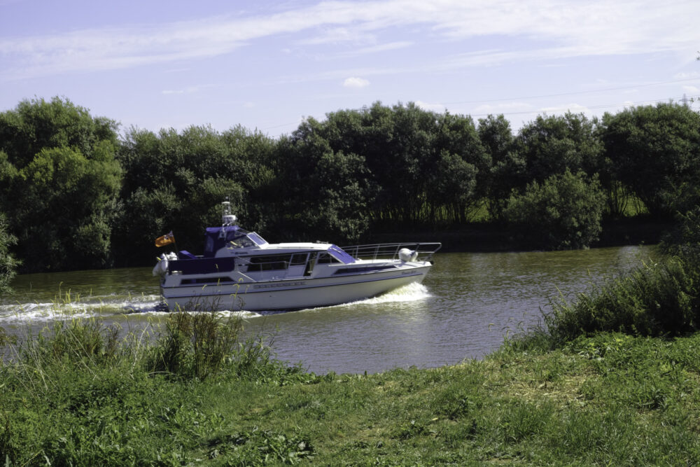
The village of Littleborough is located on the River Trent in North Nottinghamshire. It is built on the site of the Roman Town called Segelocum. It is within the Parish of Sturton Le Steeple that is two miles to the west.
The 12th Century Church of St. Nicholas is the oldest and smallest Church in Nottinghamshire. There is speculation that the church was founded by William the Conqueror, as it stands in what was his manor of Mansfield. The church was probably built in the second half of the 11th century. It was restored in 1832, when the vestry was added. The vestry was rebuilt in 1900, and the church was restored again in 1973. It was vested in the Churches Conservation Trust on 1 April 1993.
Roman Town of Segelocum
Littleborough used to be the Roman town of Segelocum, sitting astride the Roman road that ran from Danum (Doncaster) to Lindum (Lincoln) and defending the river crossing there.
The Roman name comes from the ‘Celtic’ word ‘sego’ meaning ‘strength’, and the Latin ‘locum’ meaning ‘place’. It certainly had a strong position, situated on a hook in the river that meant it was defended on three sides by water. The river has since changed course, and so no longer runs along what would once have been the south-west part of the town. Littleborough used to defend the Trent River river crossing, which was by means of a ford which led to Marton. The town sat on the high ground from where the church is now and to the north-west.
It seems that the ford was improved by being surfaced in Roman times with large flags of stone. Timber uprights marked the edges of the caus Littleborough used to defend the Trent River river crossing, which was by means of a ford which led to Marton. The town sat on the high ground from where the church is now and to the north-west.eway, presumably to keep the people crossing the river on the right course. The ford was removed during navigation works in the 1820s.
The church of St Nicholas made use of recycled Roman tiles when it was built. The tiles were used as levelling courses. The site of the Roman town is a Scheduled Ancient Monument, which means it is very important both locally and nationally, and is protected by law.
When the town changed its name from Segelocum to Littleborough is not known, but in the Domesday book it is recorded as ‘Litelburg’ and the village belonged to the King. The element ‘borough’ in the name comes from the Old English ‘burgh’ which is often used to places where there are remnants of Roman encampments or towns. The medieval name therefore refers to the Roman town having shrunk to just a few houses. It may have also been known by another name; it is generally accepted that Littleborough may be the location of ‘Tiowulfingacaestir’ where Bishop Paulinus conducted a mass baptism in around 628 AD.
The Domesday Book says the following about the village:
‘In Littleborough [are] 4 bovates of land to the geld. Land for 1 plough. There 14 sokemen and 2 villans and 4 bordars have 5 ploughs. Meadow 3 furlongs and 10 virgates long and 2 furlongs broad. This sokeland is worth 10s.’
There is a ferry marked at Littleborough on Chapman’s map of 1774, which linked the village to Marton, and was used until fairly recently.
Please be aware that the site of Segelocum is a Scheduled Ancient Monument, as such the only Archaeology work that can be conducted MUST be in accordance with law covering Scheduled Ancient monuments. For example it is a criminal offence to carry out metal detecting without the permission of English Heritage.
2020 is the 400th anniversary of the “Pilgrims” passage to the New World on the Mayflower
2020 is the 400th anniversary of the “Pilgrims” passage to the New World on the Mayflower.
The small village of Sturton Le Steeple and the surrounding area is the very cradle of the Pilgrims movement. This is a timeline of events that led up to the crossing of the Atlantic Ocean on the ship “Mayflower”… and the rest as they say is History!
The lord of the Manor of Sturton in the early part of the reign of Henry VIII was Thomas Lord Darcy (1467-1537), appointed, June 18, 1509, as warden of the forests beyond Trent. He brought himself into trouble through his support of the rebellion known as the Pilgrimage of Grace, that broke out in Lincolnshire in the autumn of 1536 owing to dissatisfaction at the suppression of the religious houses. George Lassels of Sturton was instrumental in informing King Henry VIII of Darcy’s involvement and Darcy was charged with treason, and executed on the last day of June 1537. A scramble for his lands at once ensued. George Lassells was in London in the early days of 1539 suing for ” the late Lord Darcy’s lands in Sturton.” His brother, John Lassells, was in the service of Thomas Cromwell, and the family gained much of the land in Sturton Parish.
John Lassells (also Lascelles); was an English sixteenth-century courtier and Protestant martyr. His report to Archbishop Thomas Cranmer initiated the investigation which led to the execution of Queen Catherine Howard. This accounts for how the Lassels family gained the lands of Darcy as a reward from the King. John Lassells along with his Brother George had a fearsome reputation as they controlled the farmers of their land in Sturton quite ruthlessly. One notable landmark they owned was the Windmill located on Springs Lane. The origins of religious reform that influenced John Robinson to start the group that became the Pilgrims starts with John Lassels. By 1546 Lassells was dissatisfied with the pace of religious reform, and about 11 May of that year he was arrested and sent to the Tower. He was denounced as a patron of Richard Laynam, ‘a London prophet who predicted the imminent overthrow of the King’, is described by John Bale as the ‘instructour’ of his friend, the sacramentarian Anne Askew, and is considered by a modern historian, A.G. Dickens, to have been the ‘leading spirit’ of the radical group at court. Lascells was arraigned for heresy on 12 July, refused to recant, and on 16 July 1546 was burned at Smithfield with Anne Askew and two others. While in prison he wrote a Protestation which was printed after his death.[8] His story is recorded in Foxe’s Book of Martyrs.
Edward Fenton was born about 1540 in Fenton Hall. in the Parish of Sturton le Steeple: In 1577 he sailed, in command of the Gabriel, with Sir Martin Frobisher’s second expedition for the discovery of the Northwest Passage, and in the following year he took part as second in command in Frobisher’s third expedition, his ship being the Judith. In 1582 he was put in charge of an expedition which was to sail round the Cape of Good Hope to the Moluccas and China, On this unsuccessful voyage he got no farther than Brazil, and embarked on what can only be described as a life of Piracy. During this period he explored all of the East Coast of America from Newfoundland to Brazil and the Caribbean Islands. In 1588 he had command of the Mary Rose, (not the preserved vessel), one of the ships of the fleet that was formed to oppose the Spanish Armada. He died fifteen years afterwards, and was buried in St Nicholas’s Church in Deptford.
John Smythe, the see baptist was born in Sturton Le Steeple in 1570. Smyth went on to found the Baptist Church and is known as the see Baptist: Smyth was ordained as an Anglican priest in 1594 having studied at Cambridge University, England. He preached in the city of Lincoln in 1600 to 1602. Soon after his ordination, he broke with the Church of England and left for Holland where he and his small congregation began to study the Bible ardently. John Robinson was born in Sturton Le Steeple in 1576 to a family that owned land in the village. His father was John Robinson who was related to the Fenton Family (See Edward Fenton above) Like John Smythe he was educated in the Church Vestry during his primary years and then went to Gainsborough Grammar School. He entered Corpus Christi College at the University of Cambridge in April 1592. He received his Bachelor of Arts degree in 1596.
The Spanish Armada is defeated by a smaller British Fleet led by Sir Francis Drake with Edward Fenton who captained the Mary Rose in the battle. This brought Fenton much fame and recognition in his home Parish of Sturton Le Steeple. The young John Robinson must have been impressed with his relatives tales of the high seas and Fentons adventures to the New World.
John Quyppe was the Clarke at Stuton Le Steeple Church during the early years of both John Robinson and John Smythe. This early education of Robinson and Smythe took place in the vestry of the Church of St. Peter and St. Paul. This covered only Latin, English and the Bible. Scientific study was not taught in those days. Quyppe must have had a profound influence on all of hip pupils and this is demonstrated with the success of Both Robinson and Smythe.
It becomes obvious that the roots of religious dissatisfaction filtered down from Thomas Darcy’s time, through the Lassels family and the growing hatred and contempt of the Roman Catholics following the events of the Armada. The adventures of Robinson’s cousin Edward Fenton in America had a profound influence on both Robinson and Smythe. The was added to when they both spent time at Cambridge University where the seeds or puritanism grew.
For a time Robinson held a curacy in Norwich, Norfolk; afterwards, Congregational minister at Gainsborough, Lincolnshire, and Scrooby, Nottinghamshire, where William Brewster and Richard Clifton were his colleagues. He became ever more critical of the established Church and in order to avoid what he described as persecution he fled to Amsterdam, 1608 with his congregation, and joined the Separatists following the lead of John Smythe. After endless arguments with the separatists in Amsterdam he moved with a section of the community to Leyden and became pastor of the Church there. Admitted at Leyden University, 05 Sep., 1613, as a student of theology. Robinson died there in 1625 ans is buried inside St. Peterskirk.
The Jamestown settlement in the Colony of Virginia was the first permanent English settlement in the Americas. It was located on the northeast bank of the James (Powhatan) River about 2.5 mi (4 km) southwest of the centre of modern Williamsburg. It was established by the Virginia Company of London as “James Fort” on May 4, 1607 O.S.; (May 14, 1607 N.S.), and was considered permanent after a brief abandonment in 1610. It followed several failed attempts, including the Lost Colony of Roanoke, established in 1585 on Roanoke Island. Jamestown served as the colonial capital from 1616 until 1699.
Between 1602 and 1620 at least 90 English ships crossed the Atlantic before the Mayflower carrying “Pilgrims”, mostly to Virginia but also to Penobscot Bay, Maine and Barklay. This includes the first shipment of slaves from Africa aboard the “White Lion”, an English “Pirate” ship that had attacked a Portuguese slave ship and stolen about 20 slaves from them.
Robinson and his friends resolved to emigrate to America. A party under William Brewster sailed for New England USA originally in the Speedwell that was not seaworthy so they transferred to the Mayflower, 06 Sep., 1620, and founded New Plymouth. As only a minority had volunteered for emigration, Robinson, as arranged, remained behind in charge of the Leyden community. His pastoral care for the colonists is shown in his letter to the Church of God at Plymouth, New England, 30 Jun., 1621.
John Robinson the Pastor and founder of the Pilgrims who sailed on the Mayflower to the New World (see above) John Carver born into an old Sturton family that can be traced back the Henry VIII era. He was born about 1584 and died in 1621 in Plymouth Colony. Carver was the author of the Mayflower Compact and became the fist governor of the Colony. His signature is the first on the Mayflower Compact. Katherine White was born in Sturton Le Steeple at a house on Freemans Lane, She firstly married a George Leggatt and later in 1615 she married John Carver the first Governor of Plymouth Colony, both sailed on the Mayflower. Bridgette White, was John Robinson’s wife, and Katherine Whites younger sister both daughters of Alexander and Eleanor White of Freemans Lane Sturton. The house that is reputedly the home of John Robinson is opposite the end of Freemans Lane.







 The Church at West Burton, dedicated to St. Helen, is a small edifice with a turret by which hangs a bell. It has seating for 26. The living which is enjoyed by the Rev. Wm. Moulds is a perpetual curacy of the certified value of £12-13s-4d, and is the gift of Mr David Walters, of Gloucester House who is also the lay impropriator and owner of all the land in the parish, except the Mill Estate which belongs to Lord Worlock. Before the conquest there was a Manor here possessed by “Spanroe” and after that epoch, part of the parish was “of the Archbishop of York’s Soc. of Laneham.” After the Dissolution, Henry V111 gave the rectory, which had belonged to Worksop Priory, to one Wm. Neville, a gentleman and his heirs.
 The village of Littleborough is located on the River Trent in North Nottinghamshire. It is built on the site of the Roman Town called Segelocum. It is within the Parish of Sturton Le Steeple that is two miles to the west.